Saturday 1 December 2012

107 landings in the rough and still fully functional

Okay its not really that many landings, well not at least for a QuestUAV.  But it seems the the world of similar commercial sUAVs its quite a lot and others would be written off by now. We get quite a few inquiries asking "how long will a UAV body last before it needs replacing" with the expectation that by 40 landings is it likely to be damaged beyond repair. This certainly isn't the case with our aircraft and our messages of "Tough Tough Tough" and "Engineered for Endurance" ring true with all our designs.

Other QuestUAVs airframes of ours have flown more, but we just haven't logged it.  The life of this one has been logged, in pictures and diaries because this one did all the work in our Bulgaria project and has done a huge amount of work since it came back.  Its been our mainstay NDVI UAV and become our general testbed for camera installations and launch testing.

So what has it been put through and how has it fared?


Let the pictures tell the story as to the condition it is in. There is some dried mud, a few tiny bits of foam  missing, but otherwise in very good condition. I've deliberately not cleaned it because the action needs to be seen.

Its landed in grass, in mud, in trees. Its landed in hard, compacted, dry, ridged  and rocky, fields, kicking up mini dust clouds as it landed. Its landed in a river (and been partially submerged trapped by the current for 20 mins), its cartwheeled at full power after a bad take-off.  Its landed in bushes (see pictures in blog below), in sunflower fields, in meadows, with birds singing and rivers babbling.  This could almost get poetic so I had better stop.  Its had a tough life, but then that is just what a QuestUAV is designed for.

The wings?  Well they are really tough. Some mud marks, the QuestUAV sticker is creased a little and a minor crack (repaired with epoxy) shown in the bottom picture here.  We didn't bother to repair it until we got back to UK because it just wasn't significant enough. After our river incident we replaced the servos, but they are still in use for R&D. The Speed controller got damaged in the river and written off, but that is all that was lost.  The motor was under the water for the full time, but it is still 100% functioning.


Its gone through two propellors. The cameras are good as new and we have a number of recent datasets to prove it (even after getting filled with water -  after service they were as good as new!).

A note on cameras and the durability of the Lumix LX5... of all the cameras we have had, our clients have had and all the bumps and tough landings they have cumulatively gone through, WE HAVE NEVER DAMAGED ONE OR LOST ONE.  That is just amazing, and its the truth.  We've had some severe crashed during testing and even written off an airframes and gimbals, but amazingly the design of the UAV with its crumple zones and the strength of the Lumix make it an incredible combination. And of course we now know they will recover even after a REALLY bad water immersion. Shame we didn't get any pictures of fish.

So there we have it. This airframe is probably good for another 100 missions or more. I wish we could keep it to see just how many missions we could get out of it, but that would just be too much fun for my staff.


Sunday 16 September 2012


Flights: 31
Days flying: 8
Images: 8000 (Vis, IR and RAW, 1 to 2cm resolution)
Operating Altitude: 2100 to 3500 ft
Environmental Temp: 5 deg to 43 deg
sUAV: QuestUAV 300 with Twin NDVI Cameras and QuestUAV 100 with Fwd Facing Camera
Output: Georectified Orthos, NDVI and FCC to 30cm Geospatial Accuracy
UAV Loss or Damage: none
Max range from Datum: 3km
Max alt from Datum: 1000ft

ABOUT THE PROJECT

Bulgaria has a rich archaeological history covering all the epochs. Pre history, middle and dark ages, Byzantine, Roman, Iron, Bronze and Neolithic. So when I was approached to participate in a “High Risk” exploration into one particular area of Bulgaria (Mirkovo) that was rich in this heritage, it seemed a fantastic opportunity to break new ground with the use of small UAV in archaeological research.

The Full Bulgarian Expedition Contingent
The project was sponsored by the HRAR (High Risk Collaborative Research Program) from The Field Museum, Canada. Their description of the project is as follows: “This research project represented the first systematic investigation in Bulgaria of the upland zone (e.g., the Mirkovo Basin) for archaeological remains through aerial reconnaissance techniques and photography. The study takes a diachronic approach, incorporating periods through the 21st century. By using innovative techniques, the research promises to place upland centers within their overall archaeological settlement context. The Co-PIs of this project are Boyan Dumanov (New Bulgarian University, Bulgaria) and John Chapman (Durham University, UK).”

LONG RANGE PREP

So it was a pretty cool project that took over a year to get to first flight, but had some fantastic results in terms of archaeological methodology, UAV Imagery, post processing and artifact collection. It is expected to lead to a number of research papers and a better understanding of the population dynamics of the area over the previous 8000 years. The project needed us to image a number of different subject types: arable land, pasture land and forest, both with known areas of archeology and with unknown areas (for prospection). Some areas also included the mountain range to the North of Mirkovo and a significant ridge to the West.

One of our makeshift workshops
The bulk of our planning had to be complete two months before departure so that every item being transported could be catalogued and translated for Import/Export requirements.  Because of the significance of the project we needed to know that everything was covered for UAV operations, including vertical, oblique imagery in visible spectrum and IR.  We chose the QuestUAV 300 with twin NDVI, and a QuestUAV 100 with forward facing Vis/IR. New aircraft were built for the project and both aircraft, ground control, full toolset, recovery poles, rucksack, transmitter, batteries, charger etc were squeezed into one of our Explorer cases.  Knowing what remote sensing is like and what the impact of failure of just one piece of equipment can have, we then doubled up on everything and created a duplicate system in another Explorer case, complete with a further QuestUAV 300 aircraft build.

Maps were an issue, both for planning and for the ground control laptops.  Coverage and availability was pretty poor so we spent days compiling our own A1 and A2 sized maps and converting them into GIS.  In the end we had excellent coverage both digitally and in paper form, but it was a lesson well learnt to be ready to work on this stuff months in advance.

TRAVEL OUT

The team that left from Northumberland comprised of myself (QuestUAV Director), Jon (Quest Systems Engineer), Dr Helen King (GIS and Post Processing) and Dr Jane Entwistle (Soils Specialist). When we arrived we took on board a new UAV team member, Sonya Tsekova, who stayed with us throughout our visit

Departure, transit and arrival was long, but went by without a hitch and all our kit arrived safely, despite now having in it a Radioactive Soils Analyser (XRF) courtesy of Jane. After an overnight in Sofia we travelled to the Mirkovo basin with our hosts, Jon and Bisserka, in the renowned JUPE (a 17 year old, well travelled 11 seater project transit van).


FLIGHT OPS

My concerns were about hot, high and heavy operations. The Mirkovo basin sits at around 2200ft with mountains rising to over 3000ft. Coupled with hot temperatures rising to the low forties and UAV’s carrying the full suite of cameras, these conditions were going to test the QuestUAV systems.  We had the benefit of knowing that a QuestUAV 200 had operated completely successfully an Atacama desert operation at 10000ft, so at least we had a head start.  I didn’t need to worry.  The UAV’s performed impeccably throughout without ever seeming to labour or overheat. The standard 9x6 prop was used throughout.

Learning from Hannes’ experience in strong sunlight in the Alps, we took a half dome tent to provide shade for the UAV (and us at times!!). It was good call – in strong heat the wing tapes loose their adhesion and ten minutes in the sun was enough for this to start happening.  Sometimes we had the shade from JUPE, the project van, to help us. Either way, finding shade was crucially important for UAV ops.

Mornings started cool and calm, giving us four hours of prep and flying time before heat and winds picked up. Then the next session would be after five in the afternoon where a couple of hours would afford us some nice golden, Bulgarian evening light. For archaeological reasons it was important to get low aspect sun conditions at times to show up such things as ridge and furrow.

What soon became apparent was that good landings were crucial.  With so many flights yet to be done and typical landings being on hard, some times sunbaked dry ground with trees, old water pipes and other obstacles around, it became important to focus carefully on minimising landing risks. We had three aircraft but the aim was to damage none. We achieved it, but the discipline of carefully assessing the landing area, wind direction and approach run certainly improved this success. A bit of a wind would reduce the landing speed, but landing in a clearing would quickly kill that benefit in the relatively still wind inside the clearing. The QuestUAV are tough though and didnt mind being stopped by the occasional tree or bush or ploughed field. Even an occasional cartwheel didn't affect the airframe, the camera(s) or the gimbal.

PROCESSING

Day by day and flight by flight the results came in, first as bunches of images straight from camera, then as processed othrorectifications, then as georectified images.  One task was to locate the "Tell" on our first of three sites.  The tell was supposedly an ancient mound, first inhabited man thousands of years ago but probably built on a number of times since. It was known that it had long since been flattened as modern agriculture took place, but that traces should still exist in the signatures left behind in the earth and rock. We flew this site many, many times whilst a radiometric survey, coring and fieldwalking took place.  Our flights comprised of visible, Infra Red , NDVI, oblique, early morning and late evening light, low, medium and high altitude. The ability of the UAVs to be launched so easily, often at different sites on one day, made the task of aerial data collection easy. 

Each flight produced a three dimensional model that would be converted to an orthorectification using Agisofts very competent  Photoscan Pro. Then as the ground control point data was added to the program a georectification would come out. As we raised the bar and became more technical with the QuestUAV 300, carrying it's twin NDVI cameras, overlapping orthorectifications from each camera would provide the information for the NDVI calculation, made using the raster calculator in ArcGIS. NDVI gave an option of  false colour - an easier way for the untrained eye to see the subtle vegetation differences that marked underlying changes in soil structure. Evidence of completely different field structures, ridge and furrow, foundations, drainage, habitation and pathways started to come out.

The mosaics also allowed Digital Elevation Models (DEM) to be produced. This then allowed the subtle contours and level changes to mapped an a scale much more accurate than could be seen in even the most detailed maps. It appears that we found the Tell and the DEM helped define it, though it was never fully confirmed as so much change appears to have happened over recent history.


With so much information to process it became a 24 hour process for the laptop we took out. Helen, our GIS expert, eventually became confined to her hut where the processing took place.  We shared the nightime task of stacking up the ortho routines. Not everyone was successful and some night were a washout because the attempt to get the best accuracy sometimes was just too much for the laptop. 


to be continued..

Sunday 29 July 2012

Flying in the Alps with GRID-IT and a Quest 200


Monitoring soil erosion in the Alps

The geography department of the university of Innsbruck has a long tradition in research concerning soil erosion in the Alps. One test site is located in the "Schmirntal", a small and steep valley about 20km south of Innsbruck.
Hannes preparing for an Alpine flight 

During the winter 2011/12, the snow conditions probably caused an increased number of so called "blaiken", small areas in which grass and underlaying soil are eroded. Since the latest ortho images were dating back to 2010, the project leader at the university approached GRID-IT with the idea to try a UAV flight, taking aerial images in order to produce an ortho image data set as basis for change detection.

Since GRID-IT is focussing exactly on these topics (UAV-based earth observation and change detection in the alpine terrain), and since this idea promised to be an interesting and challanging project, we soon agreed on a flight during the last week in July. On Thursday, the weather was unstable, so we had to postpone for one day. But Friday was very promising, and therefore we started early in the mornign at about 5:30am, to avoid the afternoon winds and thermals.

We could cover most of the altitude with a Jeep, only the last 200-300m had to be done by foot. The Quest200 was packed into a rucksack, the wings mounted separately. We also took a high precision GPS and colored markers to be used as ground reference points.

QuestUAV 200 on launch
Close to the ridge, we found a relative flat area, where we could setup our equipment. The area still had a 5-10% slope was covered with a series of grass humps. The slope left us only one direction for takeoff and the opposite way for landing. The Quest200 was put together easily and within half an hour, we were ready to get airborne.

The QuestUAV launch system is very safe and almost nothing can go wrong with it. But still, knowing that due to topography, aborting the launch was not an option, added some stress to it. But as expected, the launch went well without any problems and soon enough we had the beautiful sight of a Quest200 flying in front of a lovely mountain scenery.

We had defined a flightplan with seven legs and a total length of about 8km. The flight path was covered exceptionally well, only some thermals and gusts pushed the UAV away from its track. We flew about 100m above launch, which gave sufficient height for the surrounding topography (we had a 1m digital elevation model and could check the height above ground for the flight plan beforehand).

Imagery captured during flight
Landing the UAV on that humpy upward slope was a bit tricky, but we managed to bring the bird down safely. Images and logger data were checked immediately and both showed good results. So we decided to try another flight, this time at lower altitude to get better ground sampling distance (the altitude difference from lowest to highest point was about 500m). Again, launch was easy - this time, we did some manual flying to get nice pictures before switching to AUTO for commencing the flight plan. However, the first approach towards the first leg was to steep and brought the UAV too close to the surface, so we aborted AUTO, flew the approach in ASSISTED and tried again. But again, we had the feeling that the UAV was getting to close to the ground, so we aborted the mission and went to landing the UAV as we did before. This time, we had some tail wind (which was getting stronger every minute) and during the approach, the motor block of the Quest200 was damaged due to the uneven ground. With the damage and the wind and thermals getting stronger, we decided to cancel the second flight, since we already got excellend data from our first flight.

After all, it was a very interesting day with lovely weather and we got some very nice data, which we are going to process during the following days. We hope to come up with a good ortho image and a detailled digital surface model, which we could compare with the LIDAR based elevation model. The main lesson learned was that much consideration needs to be given to the right choice of a landing site, and we will think of some other concepts to support landing in difficult terrain.

Tuesday 26 June 2012

Training with a QuestUAV 200 In Finland


At the beginning of this year I entered an interesting email discussion with Romi Rancken, a senior lecturer in Finland. He was thinking about leaving his current work at Novia University in Finland  and studying the forests and archipelago of Southern Finland using UAVs (rotary and fixed wing) as part of his set of research tools. 

We threw a few ideas around, but they all seemed quite challenging, either involving lots of trees or lots of water… neither of which are particularly healthy for UAVs.  Trees can generate huge turbulence and wind shear, whilst large bodies of water or sea leave any UAV pilot feeling slightly uncomfortable unless … um … whatever … there is so much not to desire flying over the sea! Living on the North Sea coast in Northumberland UK I’ve done a lot of UAV flying by/over the sea and lost a couple of  UAVs there. Total write-off; the UAV may survive but the salt kills everything pretty soon afterwards.

Anyway, as I write this blog I’ve just come back from a great few days in Finland, living with Romi and his wife Tuula, and flying around the forests of Southern Finland. We all agree that at times it was tough and challenging!  I’m sure Romi occasionally have wondered what he had let himself in for. I wondered too, but at least I had great faith in the QuestUAV 200 and it’s ability to handle a breathtaking amount of violence, and still live.  My faith was well placed.

Romi, Jon and George with the 1990 Novia UAV
and the QuestUAV 200
Prior to our arrival, Romi, an experienced forester, wanted to operate from a clearing that is in the heart of his University research area. My instincts put me decidedly on edge operating so close to trees and in a relatively small clearing.  To the inexperienced eye, a 200m x 250m clearing would seem fine as a flyng site, especially with the protection at ground level from the winds. As it turned out, the winds and turbulence would be considerably worse than expected.

Our arrival to Helsinki was in torrential rain and the forecast wasn’t brilliant with more rain and winds expected throughout our short stay. The first night of our arrival I introduced Romi to the simulator and we spent a couple of hours working on flying, perspective, take-offs and landing. 

A quick 3d ortho created from100+
images on a very windy flight
The simulator is a key piece of training, complete with a QuestUAV aircraft to fly around and get to know the transmitter. Whilst the QuestUAV is an autonomous beast and will do all the flying itself, like many other sUAV’s, its unwise to leave every situation for the UAV flight systems to sort out.  Some things will happen (bad planning, weather change, unexpected winds or turbulence etc) that the intervention of a pilot, if only for a few seconds, might save the day.  Of Romi’s crew (including a Russian businessman/researcher called George Rybakov) I thought that one of them would have some previous RC experience.  I didnt pick up that the these skills didnt exist before arriving in Finland and our normal process in UK of sending a simulator and transmitter a few weeks ahead of the main delivery didnt happen.  Little did we know we were going to step into such a tough training scenario with  a difficult flying field, rough weather and inexperienced flyers,

Day one was classroom training and an introduction to the equipment with flying in the afternoon.  Classroom training was standard – lots of information to take in, lots of questions to answer and lots of interest in the whole process.  When we arrived at the flying site, it was agreed that the wind was too strong for Romi/George to operate in, but just within limits for us to operate in. I saw trees in the distance being affected by winds in a way that I didn’t like and gave that unease in my stomach. However the forecast wasn’t expecting to get any better and it was the “well we are here now” decision that won.  We launched. Thankfully the QuestUAV is such a tough beast because it got pounded and thrown around in the turbulence and winds like nothing on earth.  Jon and I thought at one stage the wings would break off the turbulence was so strong. It was almost impossible at times for us to operate in manual mode and assisted mode was essential to provide the rapid responses required for stable flight. Unbelievably the flight returned a load of good photographs and a test DTM was produced from the hundred or so images taken.

A typical single image.  Lots of trees!
Day two brought the opposite weather – calm winds brought about through heavy rain. A publicity shoot with local news and papers was forecast around lunchtime.  The interviews brought a lot of interest in the new technology and Romi's intentions for them, and our fame was soon to hit the front pages of the local newspapers, despite not a single take off or landing happening. It also gave us time to try out a new concept in turbulence assessment.  The recovery poles became very tall windsocks. This allowed a much clearer assessment of how the wind was moving and twisting through the clearing. Even in the lights winds the tapes would be completely in opposition to each other showing strong windshear and rotors.  

Windpoles showing varying winds,
even in light winds

With the press through and a clearance coming we finally got onto proper training with Romi and George practising launches, take offs, autonomous flight and landings. The site was a former landfill that had been compacted to a hard, wet surface. So landings were muddy and hard too and the UAV got covered in a layer of wet mud and grit, but the new crew got in sufficient practice to be able to autonomously take off and land the QuestUAV.  It would have been good to spend more time on the hands-on flying, but the conditions and circumstances were all pretty much working against us. The concept we have of the QuestUAV being akin to a Landrover rather than a Lamborghini held true. Any damage from the day was repairable with the minimum of tools and experience. Tape and superglue repairs ended up with a UAV even stronger than it arrived and ready for more action.

Romi launching
We all learnt so much on this trip that would take pages to write about. The two and a half days packed in a huge amount and there was an agreement with all of us on a number of things. Firstly, the turbulence, wind and weather conditions were something we had no control over but choosing a better flying site would have had much better results.  Secondly, our recurring theme of “training needs to take more than two days, and it needs to be done on our own turf”, held true.  This was our first foreign training and a lack of familiar training facilities made quality training hard to achieve. And thirdly …  and most importantly, the QuestUAV is incredibly tough, easily repairable, and produces excellent imagery under the harshest of conditions.

We look forward to Romi and George's results in the weeks ahead...

And from Romi...

"I read your blog - it's a nice description of your experiences here and lessons learnt! 


Being a QuestUAV customer means that you don't only get the ordinary, correct and smooth treatment you could expect from a seller, but you also get a feeling of being a co-developer of a novel technology in a team of enthusiastic people.


We had two successful flights in Västankvarn on Tuesday with very good landings. We flew at 80 meters and the imagery was good. Next time we will fly at 110m for better mosaics."
           

Sunday 17 June 2012

Mars, The Atacama Desert and Digital Terrain Models

As space missions become more enterprising, the technology driving the systems becomes more demanding. The next round of planetary Lunar and Mars rovers must be able to survey more, quicker, and with little input from their commanders on earth. In effect they need to become autonomous; thinking for themsleves, driving without human command, sensing the landscape, assessing dangers and navigating safely in order to uncover the fundamental questions they have been sent to answer.


This technical wizardry cant be be left to just happen on an alien planets surface and has to be thorougly tried and tested long before launch. Ruatherford Appleton Labs in Harwell have been developing just this technology driven through a multinational project funded primarily by NASA but with a significant input bfrom the European Space Agency (ESA) and companies such as British Aeropsace Engineering (BAE) and Mcdonnel Douglas. Their testing includes settings tasks on real terrestial surfaces that simulate the martian landscape and this is where QuestUAV systems have been empolyed. For every task, a detailed three dimensional map, a Digital Terrain Model (DTM) is required of the lanscape.

The partnership for us started after staff at RAL systematicallly looked at every UAV system available on the market, in both the rotary and fixed wing classes. After a detailed analysis they chose to ask QuestUAV to provide a sample DTM of one of theri test sites. Despite the DTM being conducted in high wind situations (est 60 mph gusts) the resuts were successful and and DTM was produced. RAL were very happy with this - their very first successful DTM -and so the relationship developed between RAL and QuestUAV. Training took place over Jan, Feb and March and in May they departed for the pre test sites in the Attacama desert where NASA had set the gruelling tasks that the navigation systems would have to prove themselves on.

The Atacama desert is a hostile place; high, dry, rocky and gritty. Landings are harsh and the air is thin. At almost 10000 ft with little graphical information to bind overlapping images, it provides a real challenge for an unmanned aircraft to operate successfully. However the crew, Prof Brian Maddison, Dr Aron Kisdi and Dr Wayne Tubby performed an excellent job, learnt quickly and brought images back that can only be described as stunning. There were issues though. The harsh surface and thin air made for rough landings and the foam nose of the aircraft became increasingly pitted. Though the nose is designed to be sacrificial the concern was that the continuous impacts with rocks would eventually break something off. In hindsight it was just fine, but subsequent modifications added a stronger "Skid Pan" to the base of the nose that worked well. Also the mixture of sharp and grity sand got everywhere. Each landing threw up a mini duststorm that got into anything that was exposed (both internally and externally). Landings also took a toll on propellors. Propellors are changed in a few seconds so its not a problem, as long as it is noticed. On the last flight damage probably wasn't picked up and when the rate of climb was significantly reduced after takeoff and the UAV seemed to be performing poorly, the pilot elected to abort the flight and conduct an emergency landing. The UAV landed fine, though probably fast and directly into a rock field, suffering mild damage to the body. Wisely the crew chose to cease flying (though the damage could have been reapired in field) and with suitable testing and imaging complete in this phase of the project the crew decided to conduct final repairs back in the UK.

QuestUAV got the aircraft body back for repairs a few days later, tidied it up, beefed up the nose and sent it back ready for round two of testing back in the Atacama desert in early June.

Over a three week period it performed faultlessly on all twelve flights, even manging days with high winds (over 40 mph). The spare UAV sent out to accompany it was never needed. The cameras got very dusty, but performed flawlessly. The motor had the harshest of lives but never missed a heartbeat. The UAV got pumellled and even accidentally flown into the ground at cruising speed, but flew again without a hiccup. (The crew, looking down on the UAV from what they thought was high ground, mistook sloping ground for flat gound and impacted the UAV on the upslope of the desert floor). Damage? A cracked £6 propellor.

It was all the news that we hoped for but didn't dare to ask ... that the QuestUAV 200 had not only survived, but passed wiyh flying colours. We even got the message that Gianfranco, the head of ESA Robotics, was pretty impressed with the UAV ... he was convinced it would not manage the harsh tasks chosen for it. But it did.

RAL will be composing the DTM's over the next months and the results will eventually form a research paper earlt next year. We are now working with RAL on a project to integrate the very capable (and very expensive) Tetracam Mini MCA into a QuestUAV 300 for a number of spectrometry tasks set aside for it in the coming months.

Saturday 16 June 2012

2 – 5 June 2012 Training with Hannes and Hans from Austria


 Image taken by Grid-IT 1 week after UAS delivery
We have been discussing high accuracy surveying through the use of UAVs for a few months now with a company in Innsbruck named GRID-IT. The company is a reseller of ERDAS, has won some interesting contracts in the Alpine areas and wanted to expand their services into the new market of low level aerial survey using small UAVs. GRID-IT aren’t without UAV experience and have been experimenting with various own-builds over the past years, including the Bormatec Maja.  However they found that the route to a successful survey using a sUAV isn’t an easy one, takes up a lot of time and money and often results in poor data.  Hence they started to make enquiries about turnkey (complete systems such as Mavinchi, Cropcam, Sensefly, SmartPlanes and QuestUAV).  They decided that QuestUAV was the right one for them and are now, at the time of writing this (one week after their training in UK), successfully flying their QuestUAV 200 system in the Alpine foothills (see image above).

After a series of emails and Skype calls throughout May with Hannes (Director of GRID-IT) both companies felt comfortable to proceed with the sale and training.  Hannes in accompaniment with an associate, Hans, (yes remembering names on this particular training was very easy!!!) came over in early June.  They found some incredibly cheap flights to Edinburgh and travelled down on the train to Alnmouth (a good train booking website is here), where we picked them up, took them to the workshop for a welcome and discussions and then took them in the evening to their hotel at the Schooner Inn in Alnmouth.

Hannes wanted to take his UAS system back with him so we had prepared his entire system beforehand and flew it with him on training whilst he was here. The system was all designed to pack in large international travel tough/carry box.   Hannes and Hans effectively had three days in and around the QuestUAV workshop where we could transfer information, iron out problems and do flights.  We found GRID-IT staff to be exceptionally skilled at their work with a very good understanding of IT systems and architecture, brought about through many years in the survey industry, and they even helped in an information exchange with us over NDVI issues.  Thanks Hannes and Hans.

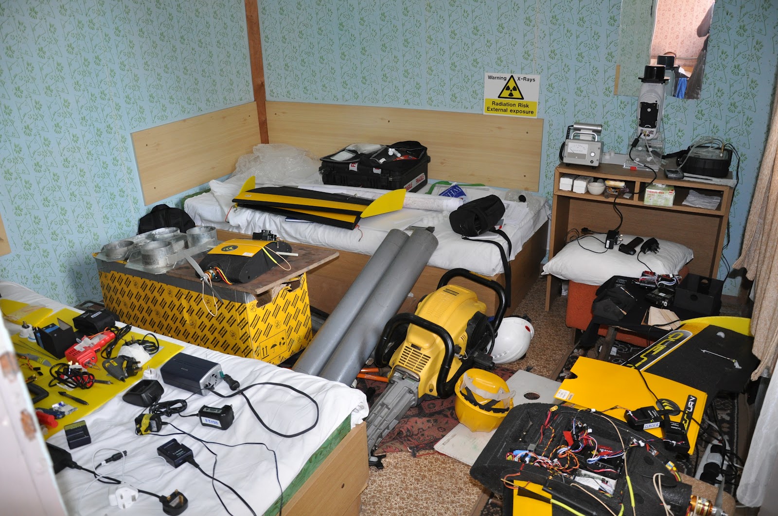
One of our big problems was sorting out international differences in the preparation of laptops and lat-long systems etc.  This all had to be done before we could fly. IT problems take an unknown amount of time to solve and for each hour taken up there is an hour less for training. We have since decided to promote the purchase of a laptop as part of the equipment list.  The laptop will by setup by us in the workshop prior to manufacturer training with all software installed, working and talking to the aircraft.

Hans preparing for launch. Red tips chosen for
greater snow visibility.
Interestingly we had negotiated a process of demo first then decision to buy (or not). Always before a big sale (more with commercial companies rather than universities) there are concerns on both the part of the buyer and the manufacturer about genuiness of interest.  The buyer wants to know that they aren’t going to get a system that might have been advertised well but doesn’t actually perform, and the manufacturers are always concerned about companies or people wanting to find out about QuestUAV, general sUAV manufacturing know-how and secrets as quickly and easily as possible for their own ends (and, yes, we’ve been in that situation a few times!).  We did the normal tip-toeing around each other for a while, trying to protect our individual interests, but at the end of the day it simply wasn’t needed. I wish there was a better way to get past this.

Though the weather prevented flying on the first day, we all felt comfortable enough to proceed with training and forego the demo.  Hannes felt that he had seen enough of the system and its performance to make the commitment to come over to the UK in the first place so the system was pretty much sold anyway before he arrived, and only something fairly major would make a change.  So the loss of the demo wasn't a great loss. Interestingly I don’t think we ever had a discussion as to whether it was bought or not – it just seemed accepted as time went on.

Our data loggers have only recently been released by SkyCircuits and still had minor bugs in their operation during training.  The primary issue is finding SD cards that work with the system. Most SD cards are designed to capture large files (typically large .jpg files for photos) rather than the tiny files that are written in data logging. We were right in the middle of another  “yes it’s working – oh no it’s not” during training that I find annoyingly unprofessional, but it’s the nature of the beast in something that is novel and cutting edge.  Thankfully Hannes was patient and helpful as we worked through this.  We now have the right SD cards and software that works, and of crucial importance, the written procedures that accompany success with the equipment. However, the holdup during training added unnecessary stresses because logger data was required to match imagery position and time for accurate Photoscan and ERDAS processing.

Power off autonomous landing
The weather soon improved though and the normal training with QuestUAV phases of design, mission preparation, flight checklists, deployment, launch, flights and landing all went well. With the initial bugs ironed out we had a good time in the sunshine and in our training field, watching the aircraft fly and do it’s thing whilst we relaxed and watched.

When most of the flying training was complete Hannes displayed his excellent flying skills whilst flying under Pilot control (full pilot control but with stability assistance). He landed the UAV just a few metres from the crew. So the challenge was set! Hans then took off to do better, but ended up providing an added dimension to training when he was flying it on his approach to land. The flightpath was slightly wide and the UAV suddenly disappeared with a sound of breaking branches as it hit the top section of a tree. It’s forgivable because we each thought the UAV was on a good flightpath to land but the perspective of this tree against it’s background put it closer than expected.  No panic… we were prepared.  Hans was a bit embarrassed but it gave us the chance to set in motion something we have never done before with QuestUAV aircraft – a full UAV recovery from a tree.  The recovery went flawlessly with the Aeroloops (see pics) and the aircraft was flying five minutes later after a quick checkover.  There was no damage at all, structural or cosmetic, apart from a few twigs stuck in the foam and no repairs had to be made.  The QuestUAV is designed to be pretty tough!

Recovery with two poles
Safe and sound, completely undamaged.
Wings and Pitot tube are designed to separate.


Hans launching again 5 minutes after tree recovery
The logger was working well by this stage and even showed the flightpath into the tree, the recovery to ground level and the walk back to the flying site.  Cool!

In all it was great working with Hannes and Hans.  They are a great team, professional, patient and skilled.  They also came knowing something that is invaluable, and it goes something like this: no matter what any sUAV advertiser promotes, it is never the case that any sUAV is autonomous and “does it all the work by itself”.  Hannes came knowing that and willing to learn the knowledge and systems that go alongside the system to make it as safe and productive as possible and to protect the investment he has made both for his productivity and his company integrity. We reckon that if a person, company or establishment already has RC or UAV experience then a minimum period of time from first call to full operation is expected to be at least two months.  For a company, person or establishment with no RC or UAV experience this needs to be extended to six months. This obviously isn’t full time but includes the gentle shift in skills and awareness gained by reading, training and discussion in order to display the required level of safety and competence to command an unmanned aircraft.
Happy guys at the end of the day. Look closely
and you might sees some tiny scratches from the tree.

On the Monday afternoon we packed the kit into the large explorer box. Unnecessary packaging had to be removed but, apart from batteries (which went in Hans backpack) it all fitted in.  Not having scales we estimated 25kg in prep for the check-in at the airport.  We got it wrong.  It was actually 35kg! It still went but it’s something we are prepared for now with scales to measure weights prior to departure.

Hannes is now home with his aircraft, flying and operating in his local area - in the process of becoming fully operational. We wish him the greatest success and look forward to the time when we expect to do more work together.


And from Hannes about two weeks after his training and many successful flights


GRID-IT is a small company located in Austria (Innsbruck), specialised in Geoinformatics and Remote Sensing. Since we are the Austrian reseller for ERDAS software, and since we did many remote sensing projects, many of them related to natural disasters and crisis management, we thought we could start to create our own remote sensing data using UAV's. Therefore, our focus is on monitoring of natural hazards in an alpine environment, which leads to some special requirements on autopilot navigation.

First we though, we could compile a system of our own, did some tests with the MAJA from Bormatec (a very nice UAV, but not quite the right tool for our applications in remote alpine areas). We soon discovered that finding the right components, which would smoothly work together was a very time consuming challenge.

After that, we did quite some research on different UAV providers, some of them in Germany, Sweden, Belgium, Poland, United States, even Pakistan (not seriously though). Finally, we found QuestUAV, got in touch with Nigel, had some very good discussions and decided to order a Quest200 together with a training in Amble. The reason for this decision was a common understanding of the requirements, the concept of a gimballed camera, which we were having in mind as well, and of course the price.

During the three-days training we found that the QuestUAV team are very nice people, excellent to work with and very professional. Since we want to carry out photogrammetric analysis of the imagery, the on-board logger is an essential part for our needs. We had to solve some problems, but now the logger and the whole system is working perfectly well.

What I really like about the QuestUAV systems is the launch concept. It is so easy and safe. And I think, the SkyCircuit autopilot is a very nice and powerful piece of technology - I think there is so much more potential in that component. In an alpine environment with narrow valleys, it is important to know how the autopilot is setting the aircraft's route. I hope, we'll get some more detailled documentation on the autopilot, soon.

So, to finalise this short introduction, we are really happy with our Quest200 system. We are currently running test with different flight plans to come up with a strategy on flight plan optimisation. We already wrote our own flight plan software, which allows us to load and visualise both the SPX flight plan and the logger data. We just recently added a module to georeference the images using the timestamp as link to the logger data. With that, we are ready to become operational, with a fully tested workflow.

Thanks, Nigel, for the good cooperation.

Hannes

Friday 15 June 2012

29 May 2012 - Receipt of Fox Talbot Award


Now this was a stunning surprise!  Last year I had submitted a portfolio of work the British Institute of Profession Photographers (BIPP).  Bearing in mind that my workhorse is just a compact camera (albeit a very nice one) and not a brace of fancy DSLR’s with extensive studio equipment to back it up, I hoped simply to be accepted into the institute at the first level of Licentiate.  However at assessment I seemingly skipped past that, past Associate level and straight into the top level as a Fellow of the Institute.  Hearing that somewhat blew me away, especially as it was a unanimous decision by the board, but that was only the start.  (My head took months to shrink to its normal size).  Unbeknown to me they had gone on to award something outstanding beyond that, which was their top photographic award that isn’t even awarded annually, only when there is an outstanding achievement that deserves special recognition from the Photographic community.

I can’t really say much more – I am still surprised to wake up each morning and remember that this happened to me.  And of course I’m pretty chuffed too!